You never know what treasures might be hiding in your attic, but if you’ve got a few vintage maps stashed in there, you may have struck gold. From early maps of America to ultra-rare railroad and military charts, these pieces of cartographic history are cherished and sought-after by collectors and historians alike. Here are 11 valuable vintage maps that could be worth a small fortune — if you’re lucky enough to find them.
1. Early maps of America
A 16th-century map of the Americas by German cartographer Martin Waldseemueller, such as his famous “Waldseemueller Gores,” is considered extremely rare, with only four known to exist. In 2005, a 500-year-old map that identified the new world as “America” sold for a whopping $1 million at auction. These early maps, which are are prized for their historical significance and intricate detailing, offer a rare historical glimpse into how the New World was first understood by European settlers.
2. 19th century railroad maps
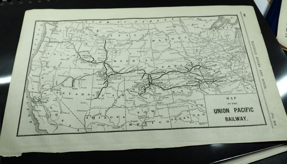
Railroad maps from the 19th century, like Rand McNally & Co.’s “Railroad Map of the United States,” can command modest prices on resale sites like eBay and Etsy (averaging from around $60 to $75). These maps are prized for their role in documenting the expansion of the railroad system that sparked the Industrial Revolution in America. If you’ve got a history buff at home, this rare expanded atlas from 1908 is also listed on eBay for close to $500.
3. Military maps
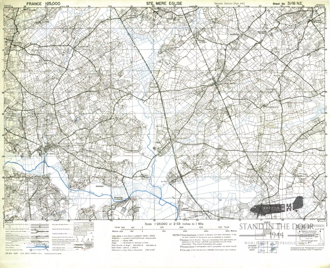
World War II-era military maps, such as those used during the D-Day invasion, are incredibly valuable because of their rarity and connection to a pivotal time in global history. Case in point: This “heavily annotated” landing map that sold at auction for $3,250. (How cool to see their notes and scribbles from back in the day!) But if you don’t want to spend three grand on a map, you can find this much more affordable replica for just 30 bucks.
4. Antique nautical charts
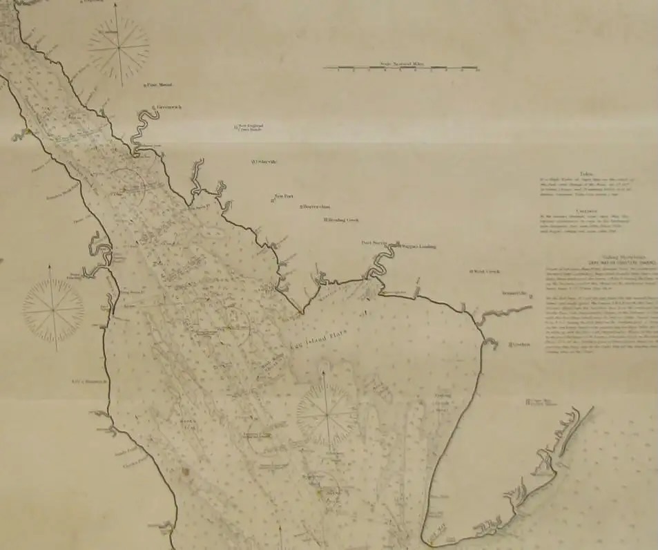
Antique nautical charts, like those created by acclaimed makers William Bligh and George Eldridge, can sell for thousands of dollars. These charts were essential for navigation and exploration, and their intricate details and historical context make them hot commodities among collectors. Take this sea chart from 1889 that’s listed for a whopping $5,000 on 1stDibs.
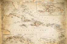
5. Bird’s-eye and panoramic maps
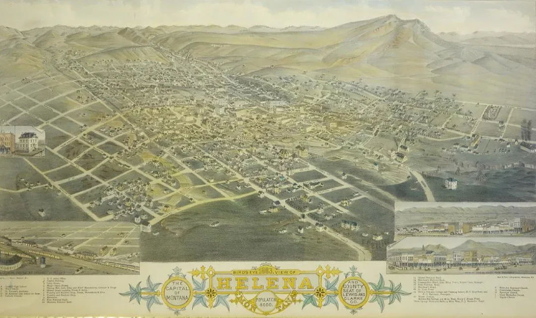
Pictorial (or bird’s-eye) and panoramic maps were created to depict an aerial view of cities, campuses, or regions. The maps are often dotted with notable attractions and local scenes, and are considered both tourism tools and decorative pieces of art. Some pictorial maps, like this one of Helena, Montana, can sell for thousands of dollars.
Trending on Wealth Gang


6. Early city plans
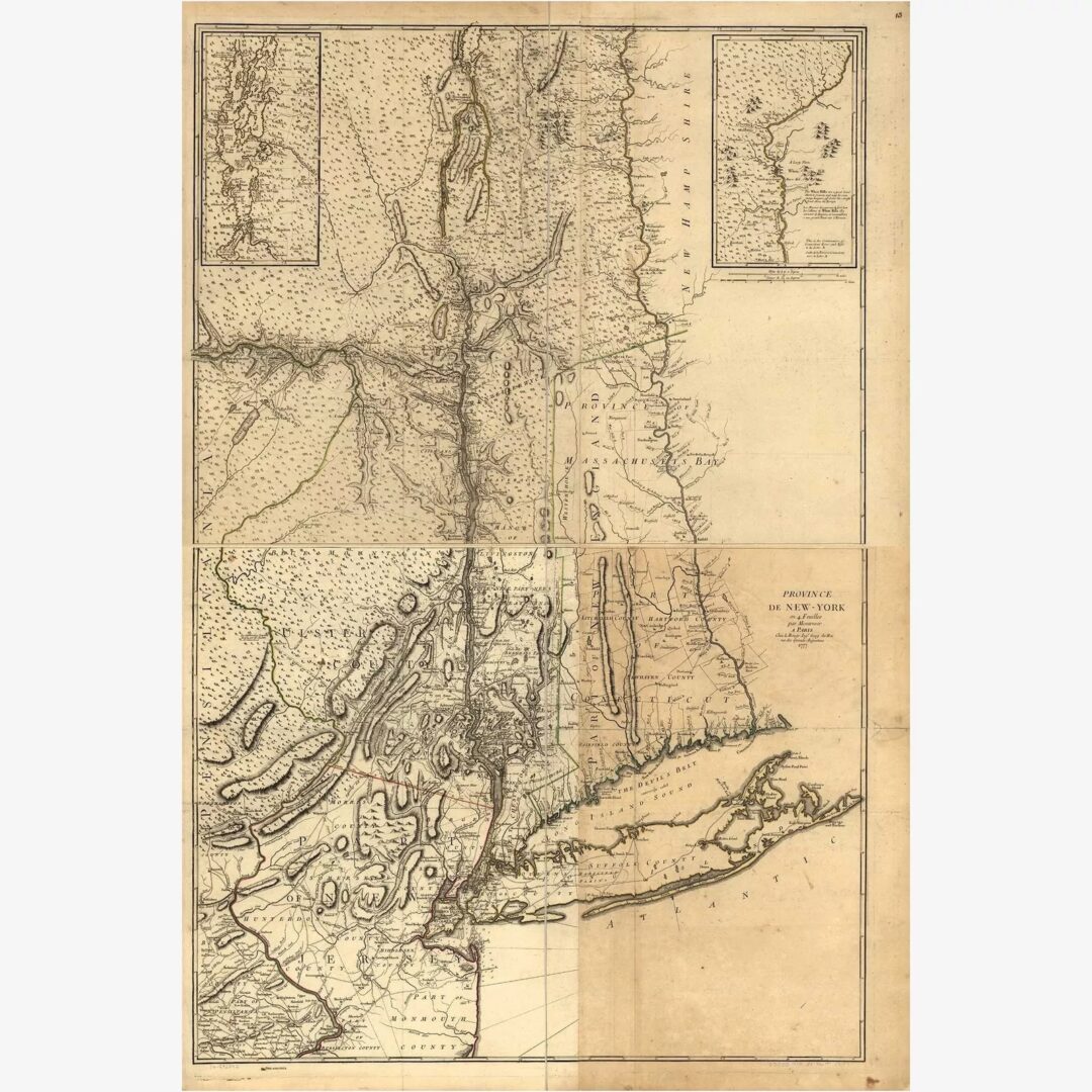
Early city plans, such as John Montresor’s 1775 map of New York City, are treasured by collectors for their unique glimpse into the city’s development during the Revolutionary War era. Just ask this guy who bought the map for $50 at an estate sale in North Carolina, only to discover on Antiques Roadshow that it was appraised for a staggering $35,000 to $45,000.
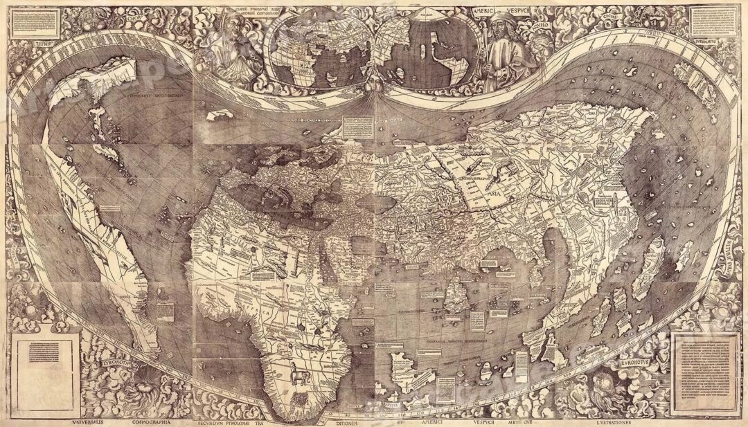
7. Vintage world maps

A 17th-century world map by Joan Blaeu, like his “Nova Totius Terrarum Orbis Tabula,” can command prices that soar into the thousands. More recently, a World Ortelius map sold for £4,000 (about $5,000) at an auction in 2012. These maps are celebrated for their artistry and the way they reflect the geographical knowledge of the time.
8. Antique celestial maps
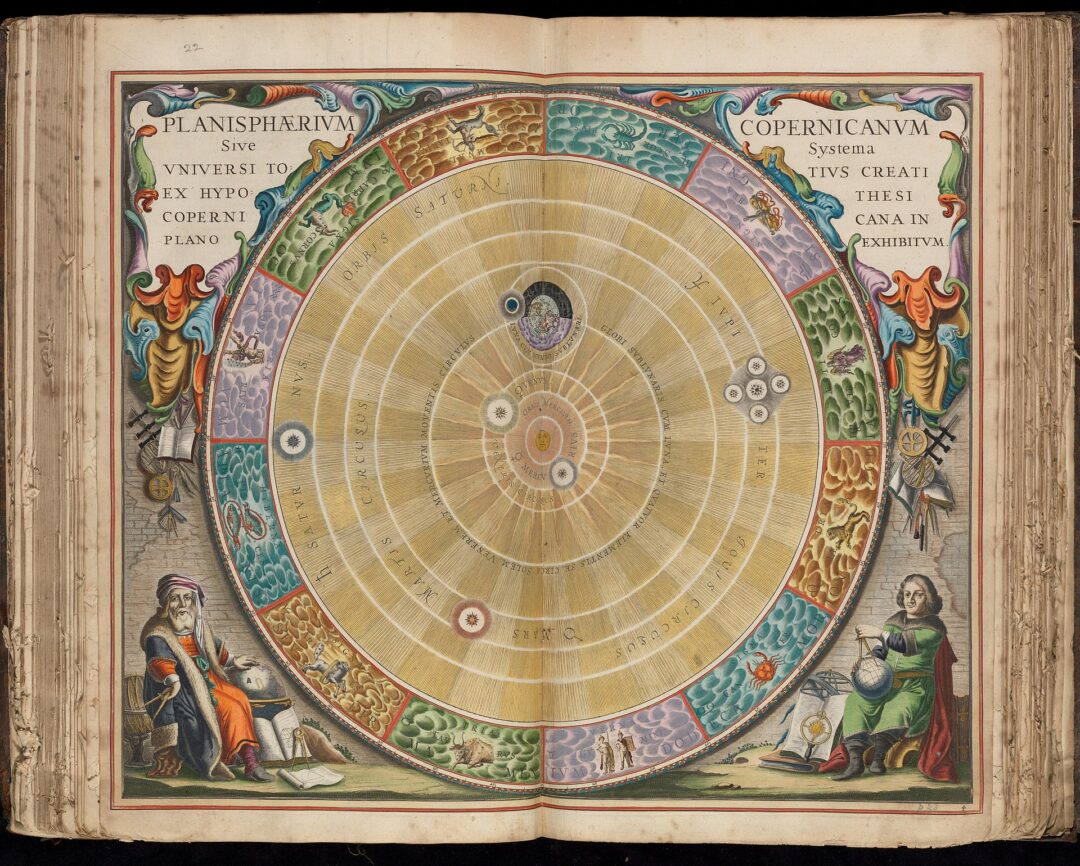
Antique celestial maps, such as Andreas Cellarius’s “Harmonia Macrocosmica,” are another rare gem for collectors and fans of astronomy. In 2015, one of these maps from 1668 sold for £68,500 (about $86,780) at auction.
Sign up for our newsletter
9. Historic Exploration Maps

Maps from famous quests, such as Lewis and Clark’s 1814 “History of the Expedition,” are incredibly valuable among history buffs and collectors of vintage memorabilia. Thanks to its connection to one of the most important journeys in American history, exploration maps have been known to fetch thousands at auction, like this one that sold for over $6,000 in 2012.
10. 19th century topographical maps
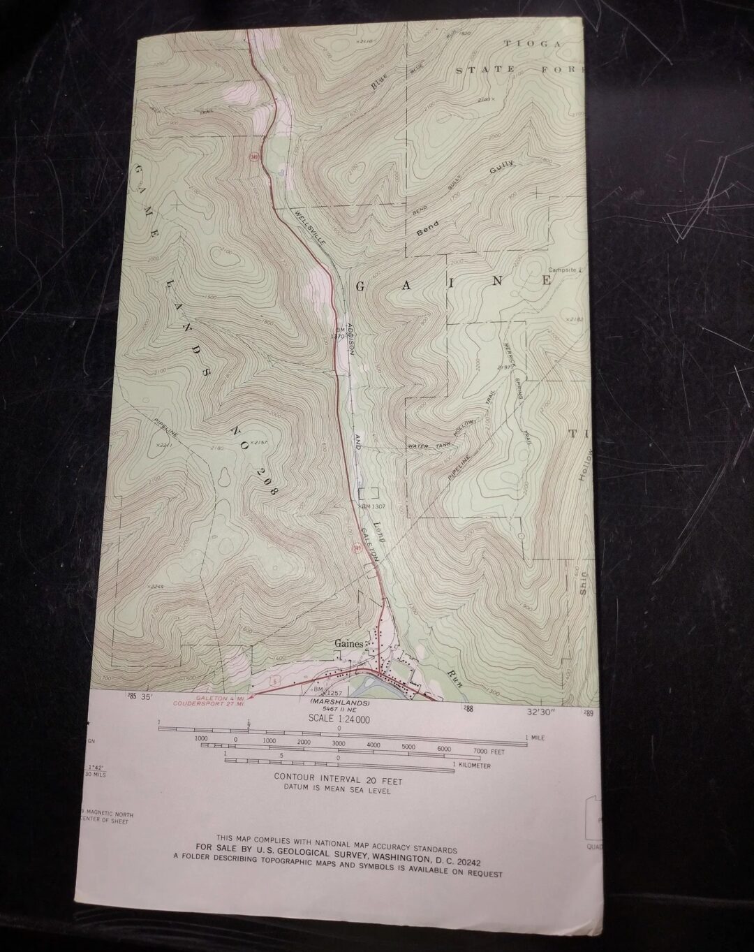
Topographical maps from the 19th century, like those created by the U.S. Geological Survey, can sell for hundreds of dollars. These maps are prized for their detailed depictions of landscapes and their role in the development of infrastructure. In good condition, you can expect to pay around $50 for one of these maps from the mid-1950s.
11. 20th century tourist maps
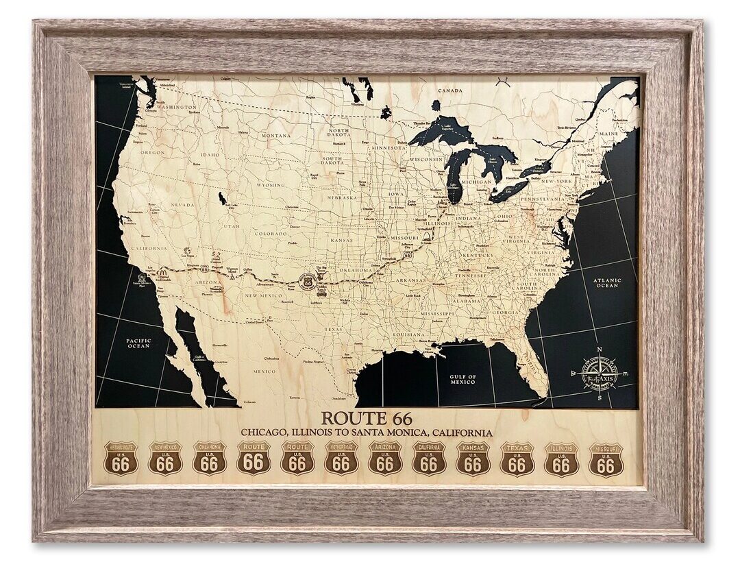
Early 20th-century tourist maps featuring national parks or famous cities and routes can sell for over a hundred dollars thanks to their nostalgic charm. Collectors are drawn to their ability to evoke a sense of adventure and nostalgia, especially with destinations that have remained beloved for generations, like maps of Route 66 or the Grand Canyon.
Curious about similar collectibles?
If you’re into collecting antique treasures, be sure to read 11 Antique Clocks That Are Ticking Treasures, 15 Photos of Valuable Antique Tools, and 15 Valuable Vintage Advertising Signs That Could Be Hiding in Your Garage.